The augmented reality app - FILAR
FILAR is an ELCA mobile solution that displays your key business information using augmented reality. Synchronizing your position and movement, your data is presented via a real-time display on top of your smartphone’s camera.
How to reveal and visualize in real-time, complex, hidden objects such as underground structures, normally only accessible using maps or a geographical information system?
If, since 2016, Pokemon Go has largely contributed to the popularization of augmented reality, the launch of the ARKit by Apple has opened up new possibilities, more realism and better performance.
As early as September 2017, ELCA designed and developed FILAR, a product that allows representation of information in 3-D, encapsulated in the real environment and captured by the camera of your smartphone.
We approached one of our customers in the energy sector, Seic Teledis, to implement within a short deadline the first operational pilot, based on real GIS data.
This solution is currently available for iOS mobile phones, using Apple’s ARKit. The solution natively integrates ARCGis mapping data (ESRI) with no transformation required.
Today our technicians have to use GPS, paper plans and laptops. These are bulky tools and sometimes require advanced skills. In the future we plan to use FILAR to conduct underground research for field services (...) This new product will allow technicians autonomy and save time.
Florian Comby
Seic Teledis
The solution now makes it possible to:
- Visualize a pipeline network and the details of the different networks (gas, multimedia, electricity...) in the field.
- Provide a sectional view of tubes and pipes to clearly visualize the cables in each of them.
- Identify cabins (central stations that distribute electricity and multimedia networks to users).
- Identify shafts (ducts accessible from the street to inspect underground cables).
- Identify houses connected to different networks and associated contracts.
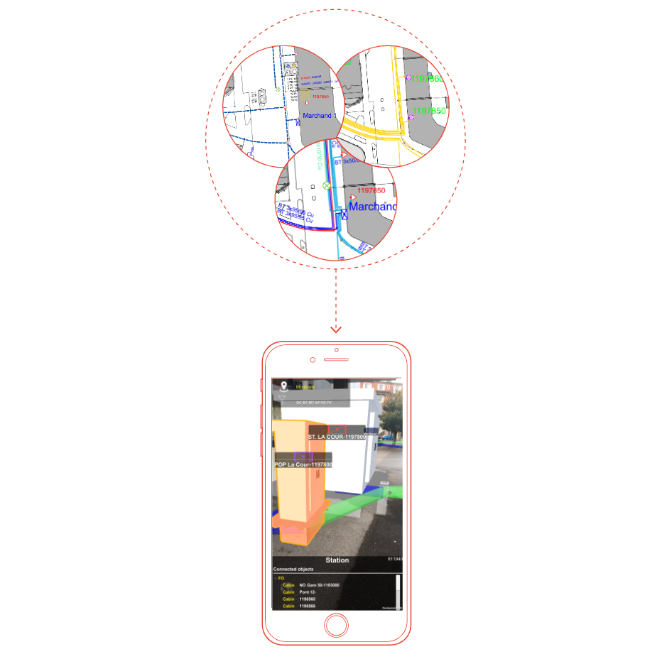
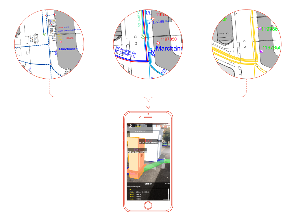
One of FILAR'S strengths is that it does not use GPS positioning, but nevertheless allows locating items within a 5-centimeter range of accuracy! FILAR offers 100% offline use on all types of land and for all kinds of infrastructure (e.g., in a basement or in a building).
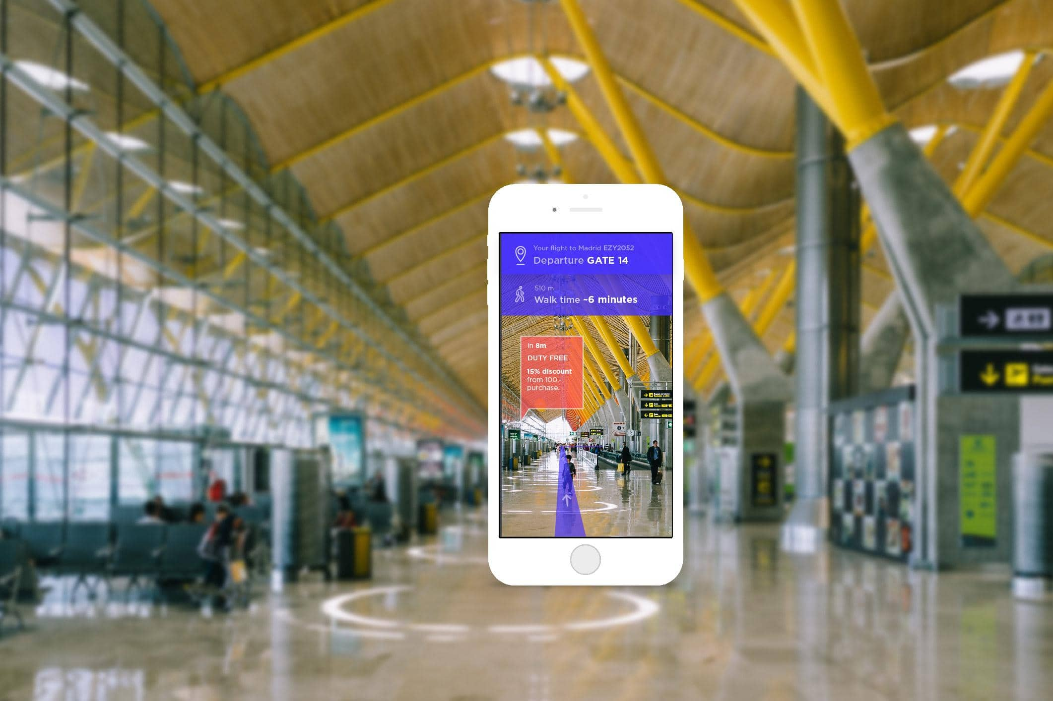
We are currently working on FILAR versions for airports, shopping centres, hospitals and universities. We also have a FILAR solution on augmented reality glasses (HoloLens).